


By the time rains came in late May, 1901, the area around the Catawba Toll Bridge had developed into its own thriving mini-community. In the early 1880s, a narrow-gauge railroad carried passengers from Hickory to Lenoir, crossing the Catawba River upstream of the Horseford Bridge. In addition to spawning new towns like Hudson, Granite Falls and Rhodhiss along the line, a hotel on the south bank, appropriately named Cliffside had been built as a stopover. By that point, Andy Ramseur, or “Uncle Andy” as they called him, had left his job as toll keeper for the bridge and moved a wagon making operation he started on the banks of the Catawba (Piedmont Wagon) into town.
Floods on the Catawba were not frequent but they did occur. Old timers cited a rise in 1824 as a high-water-mark for the river. What came in the late spring of 1901 bested the old level by seven feet. The flood washed away a portion of the Cliffside Hotel and all of the Horseford Bridge. Just before the deluge, local government officials acknowledged the bridge needed replacement but could not agree just how to go about funding a new one before Mother Nature made the question a moot point.
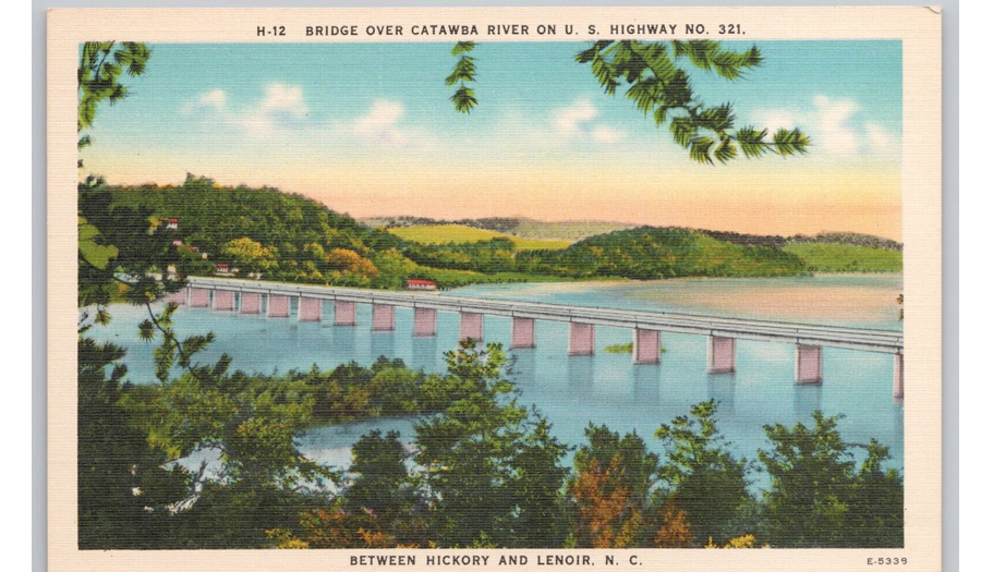
Photo: The bridge so nice, they made a postcard of it.
Citizens vowed to rebuild. Catawba County, Caldwell County, and the City of Hickory contributed $1,500 each, with Lenoir throwing in $300 for a new bridge that stood for 15 years. Then came the Great Flood of 1916. Gone again was the bridge in the greatest natural disaster western North Carolina had ever seen up until that time. By then, automobiles had begun to replace horses so there was no question that a new structure was necessary. The issue centered around how it might be replaced. Estimates of $7,000 were quoted if the new bridge were built of wood, $16,000 if concrete and steel were used. They wisely chose the sturdier option.
It was also during this era that a series of dams were also built to control the water when it got high. The ancillary benefit of all that water being used to generate electricity was becoming popular. Dams at Rhodhiss and Oxford bookended the river, in essence creating Lake Hickory, and ideally a safer river. During reconstruction, the height was raised another six feet to help ensure the new expanse would avoid the fate of its predecessors. Even five solid days of rain in August of 1940 was unable to sink the bridge along what by that point had become US Highway 321.
By the 1960s a second bridge paralleled the first to accommodate four lanes of traffic, with the northbound bridge being replaced in the 1990s. Future plans call for an even longer and wider structure over the Catawba as the road has become so heavily traveled that a six-lane highway has become necessary.
We’ve come a long way from old river crossings, but as recent events have demonstrated, no bridge, not even one of steel and concrete, is safe from the ravages of weather.


