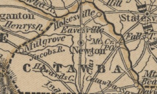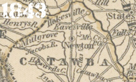
This map shows how Catawba County looked in its first year of existence. The basic shape is there but much of what made up the county in 1843 would be unrecognizable today. It just goes to show that nothing is inevitable.
 Notice how close the southern border comes to the town of Lincolnton. That’s because a fiery legislator named Nathaniel Wilson wanted to split the courthouse in Lincolnton in half, the northern side being in Catawba, the other half still in Lincoln. It seems “Thanny” as he was called, had a vendetta against the city folks of Lincolnton. When he went with his father for court week when he was a kid, the boys in town made fun of him and his homespun clothes. Embarrassed, he swore that he would one day split the town right down middle, including the weathervane on top of the courthouse. As a politician, which he became, Wilson championed the rural constituents of then Lincoln County.
Once elected, he entered a bill to sever off the top portion of Lincoln County to form Catawba. He didn’t quite carve the courthouse in too but he came close. The boundary was about a mile north. However, others had been carving on Lincoln County too. Cleveland took part of it in 1841, then Catawba the following year, but when Gaston took more in 1846, there wasn’t much left. The General Assembly took back part for Lincoln that year, moving the boundary north by 5.5 miles, allowing Lincoln County to get back Reepsville, and what became Vale and Denver.
The other curiosity of the map is the phantom cities that are no longer around. Eavesville? It was a community just north of Old St. Paul’s Church. It was west of Conover and east of Hickory. Also, Hokesville? It was situated between the river and Rock Barn in the Catfish (Bunker Hill) area. However, neither took off as a town.
Replacements like Hickory and Conover had yet to become prominent enough to warrant a designation on the map. Roughly where the “o” in Hokesville is situated, Hickory was still just a tavern in 1843, a stop along the Silver Creek Road for stage passengers heading to Morganton. It would take the arrival of the railroad in 1860 to grow both Hickory (1870) and Conover (1876) into towns worthy of designation on future maps. Newton is there of course. As a planned city, in the center of the new Catawba County, it was centrally placed so that when court week came, everyone was within a day’s ride of the courthouse.
The old map demonstrates how rural Catawba County was at its inception. Most folks did not need a town in 1843, except for when legal matters came up. Farms were self-sufficient. Most people in those days did not travel more than 20 miles from where they were raised during their entire lifetime. A trip to Statesville would have been a singular and noteworthy moment in their life. As people got more mobile they needed a county to fit their needs, and thus new towns (with roads to get there) were born. It just goes to show cities can come from vacant fields and boomtowns can go bust. They certainly have in Catawba County.


